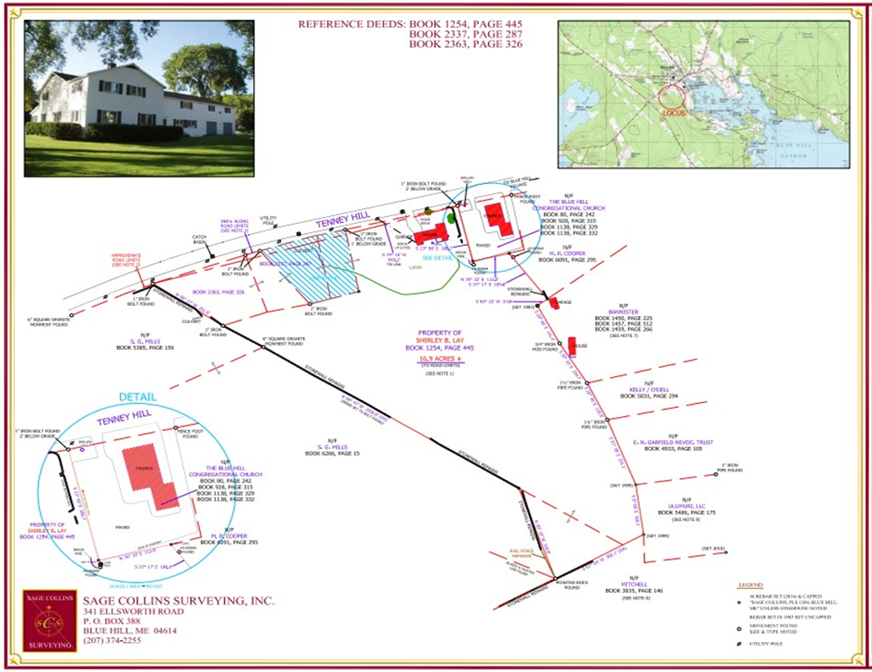
The parcel proposed to be acquired consists of ~16.9 acres in total, of which the civil engineers estimate that ~3 acres would be required for the public safety building and associated parking/vehicle movement areas.
The Parcel
The existing building on the property is located in the northeast corner, leaving substantial acreage (albeit including some wetlands) available for future use.
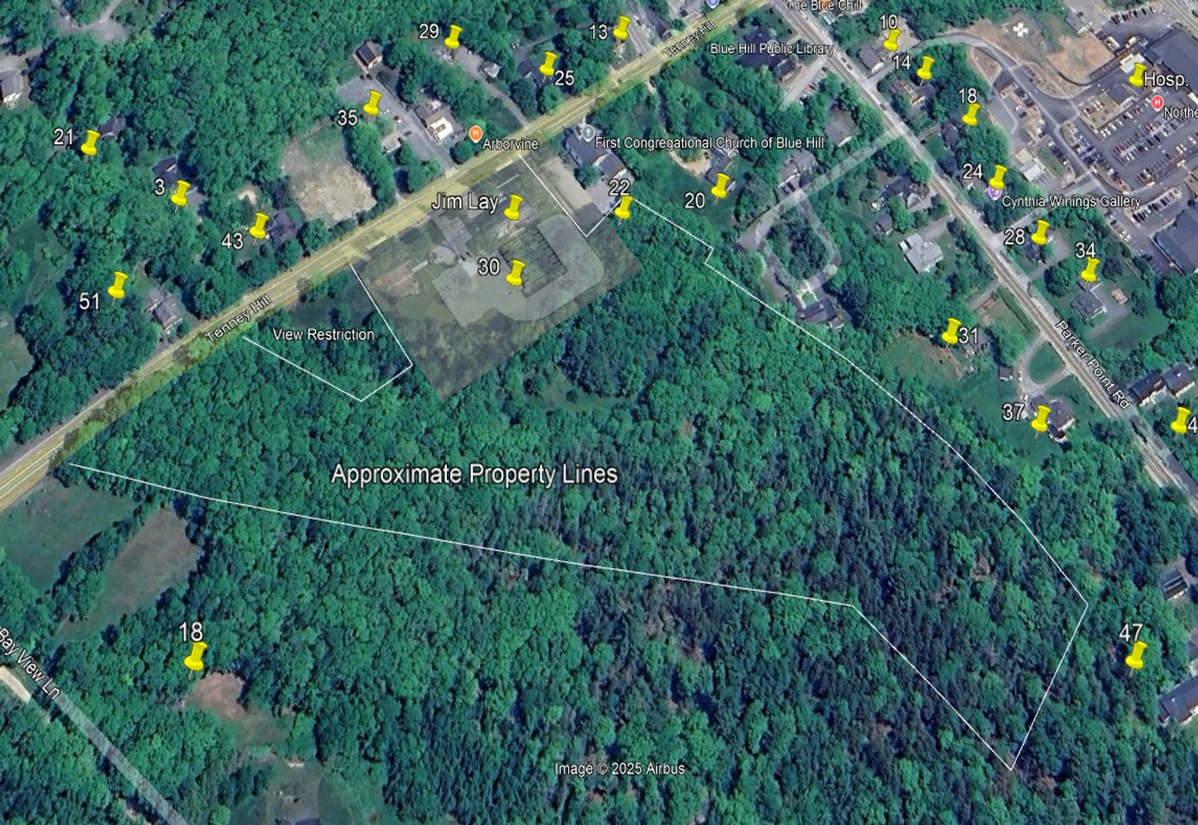
The satellite photo overlay shows the extent of the parcel and its proximity to the residences on Parker Point Road. This image also includes a shadowed portion showing the expanded building footprint and the current community garden area.
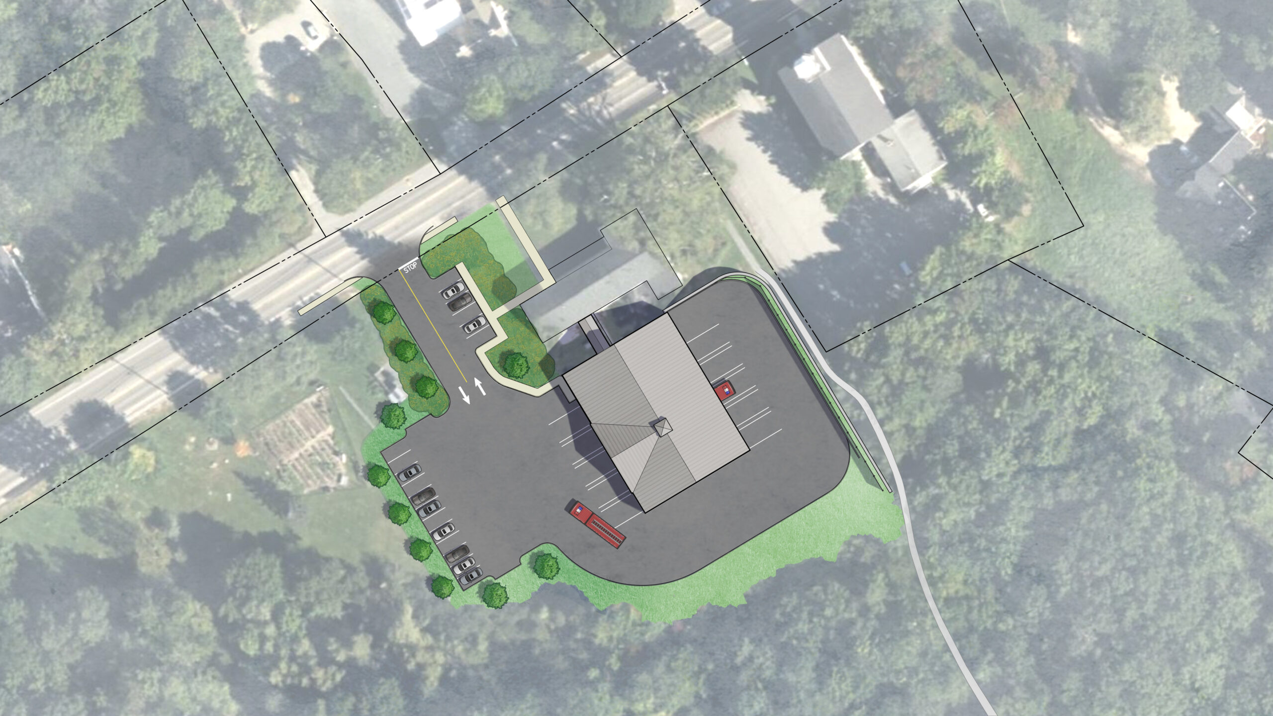
Building Site Detail
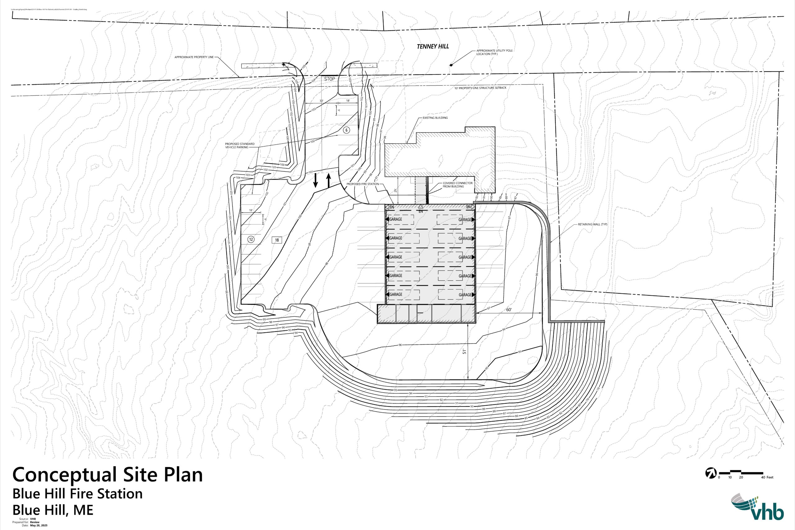
The conceptual design of the public safety building–including both the existing dorm building and a newly constructed apparatus bay–is shown below. This particular graphic was produced in connection with the engineers’ evaluation of the turning areas required for fire trucks.
The site will require some fill to achieve the required level surface. But the amount (and cost) of the fill required will be substantially less than for the other properties considered.
The site will require some fill to achieve the required level surface. But the amount (and cost) of the fill required will be substantially less than for the other properties considered.